Many of the residents of Gush Etzion — a settlement bloc located just south of Jerusalem in the occupied West Bank — do not see themselves as settlers. Because their houses, they claim, were built on land bought by Jews before 1948 or on territories designated as “state land” during the 1980s and ’90s, the expansion of these settlements is nothing more than a continuation of pre-1948 Zionist endeavors, distinct from Israel’s extensive construction in the occupied territories since 1967.
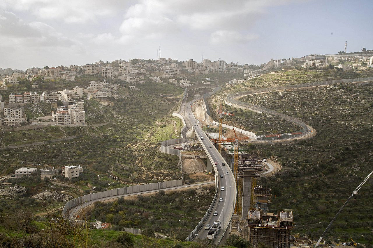
Successive Israeli governments have invested substantial efforts in fostering this view among the residents of Gush Etzion: building highways connecting these communities to Jerusalem, encouraging economic and touristic development, and constructing high-walled bypass roads or tunnels in order to hide the neighboring Palestinian communities from view. But there are times when the illusion is cracked and the bluff is exposed, when it is once again clear for everyone to see that all the settlements are alike — at least when it comes to plundering and taking over Palestinian land.
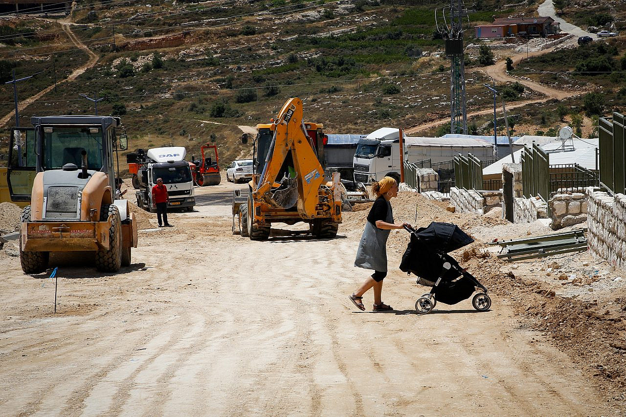
Such is the case with the new construction plan in the Elazar settlement, which the Gush Etzion Regional Council submitted to the Civil Administration’s Higher Planning Council — the body that approves all construction plans in Area C of the West Bank — in July. While ostensibly linked to Elazar, the plan in fact outlines a new suburban settlement called Netiv Ha’avot. If it sounds familiar, that is because it already exists in the form of an unauthorized outpost, where Israeli settlers have built a few dozen homes over the past two decades in violation of court orders to evacuate.
If approved — and it would certainly be in keeping with the government’s efforts to double the West Bank settler population — the plan would see the construction of 431 housing units consisting mainly of single-family homes, built over an area of 294 dunams. In effect, this would mean the transformation of a small illegal outpost into a substantial new settlement 20 minutes from Jerusalem.
Avoiding scrutiny
Establishing new settlements under the guise of adding neighborhoods to existing ones is a common method employed by Israeli governments, even when there is minimal physical or communal link between the “neighborhood” and the original settlement. The current government is working on the legalization of 70 outposts via this strategy, which avoids the need for an official declaration of the establishment of a new settlement and thus allows the settlement project to advance without attracting much notice. If an international body were to voice any criticism, Israel could claim that it hasn’t violated international agreements, such as the Oslo Accords, or its promises to successive American administrations.

Yet the Netiv Ha’avot plan is noteworthy in other ways. The proposal outlines long strips of residential buildings connected by narrow roads, encompassing large enclaves of open space — land that is currently owned and cultivated by Palestinians mainly from the nearby town of Al-Khader. According to them, the Israeli army already frequently blocks them from accessing their property, even after Israel’s Supreme Court ordered the eviction of some illegally-constructed buildings on privately-owned Palestinian land.
If the new plan for Netiv Ha’avot is approved, it is estimated that Palestinian landowners will lose access to between 300 and 550 dunams, either because the land would be swallowed up into these enclaves or because they will be prevented by the army or the settlers from approaching the new “neighborhood.”
That Netiv Ha’avot is a new settlement and not a neighborhood of Elazar is also evident from the fact that its main access road will not even come from the “mother settlement,” but rather directly from Route 60, the highway connecting Jerusalem and Hebron. The plan does propose a road that would connect Netiv Ha’avot with Elazar, but this route — already in use today — passes through private land, so it is legally impossible to plan it.
Environmental concerns — such as conserving natural land, which are standard considerations in Israeli planning — appear absent from the planning of Netiv Ha’avot. The neighborhood will sit atop the Na’aman River, descending westward from Jerusalem into the Nahal Sorek (Wadi al-Sirar) basin, a UNESCO-recognized area with millennia of agricultural history. Indeed, ecological considerations often take a back seat to settlers’ quality of life and territorial expansion in the West Bank.

Part of the new settlement will be built on “state land,” making use of a common settlement-building tactic developed in the 1980s which asserted that most of the land in the West Bank was not officially registered to private owners and that, according to Ottoman law, uncultivated land belongs to the state; the state then allocates this land exclusively to Israelis.
The process of handing control of the land in the Netiv Ha’avot area to settlers is not yet complete: it was declared to be “state land” only in 2014, after which the landowners filed an appeal and the appellate committee determined that the boundaries of the declaration should be re-examined. While these legal proceedings may take some time, the Gush Etzion Council has already submitted the Netiv Ha’avot plan, hoping to move forward on its construction.
Most read on +972
Dozens of illegal buildings are being constructed in the area — all without prior government approval, recognized land rights, or building permits. Despite nominal demolition orders, these buildings remain standing. And more are soon to be built, essentially doling out rewards to criminals.
The promotion of the construction plan in Netiv Ha’avot does not deviate from the methods used in other settlements, but it does indicate how far removed the legal planning procedure in Gush Etzion is from the standard process in Israel. While residents of this bloc commute daily to Jerusalem and the center of Israel via the multi-million-shekel “Tunnels Road,” their very presence in occupied territory is bound up with land confiscation, the whitewashing of outposts, and unauthorized construction. And they call this Zionism; make of that what you will.
This article was first published in Hebrew on Local Call. Read it here.


